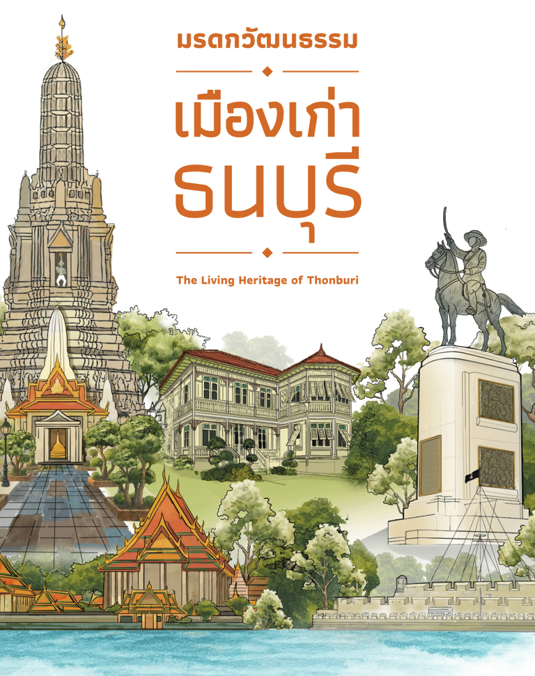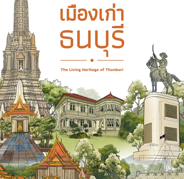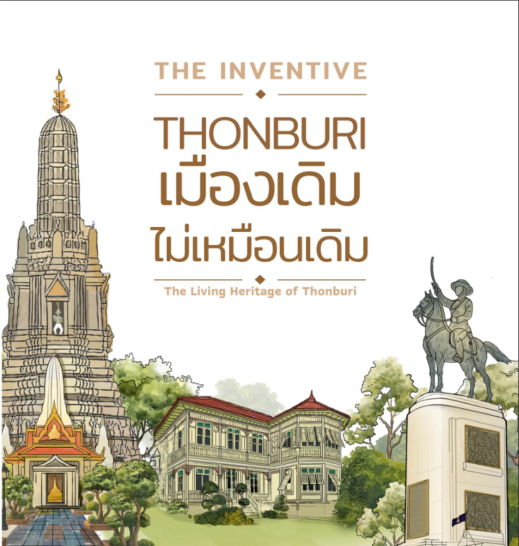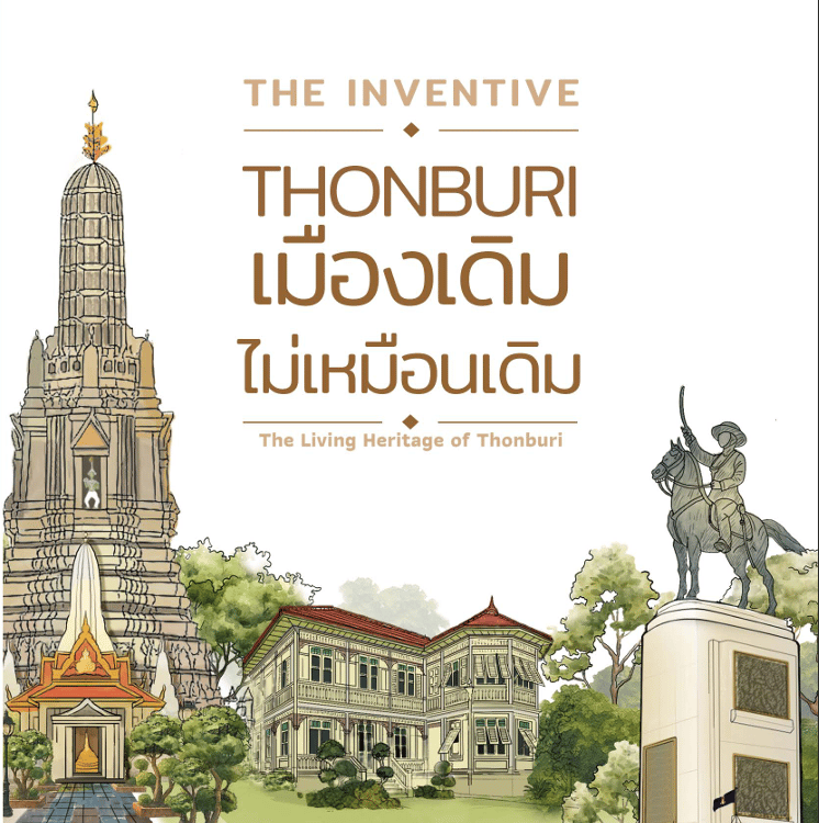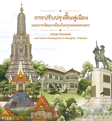
Urban Renewal Planning of The Historic Thonburi
Typology:
Urban
Location:
Bangkok, Thailand
Appointment:
2024
Completion:
2025
Status:
Master Plan
Client Name:
City Plannina and Urban Development Department, BMA
Land Area:
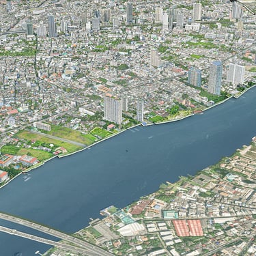
18 s.q. km.
Built Area:
-
Project Credits:
Neeracha Chongpermwattanapol
Description
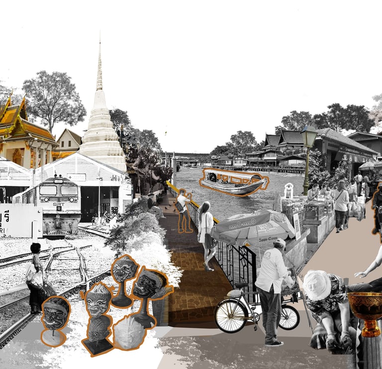
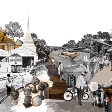
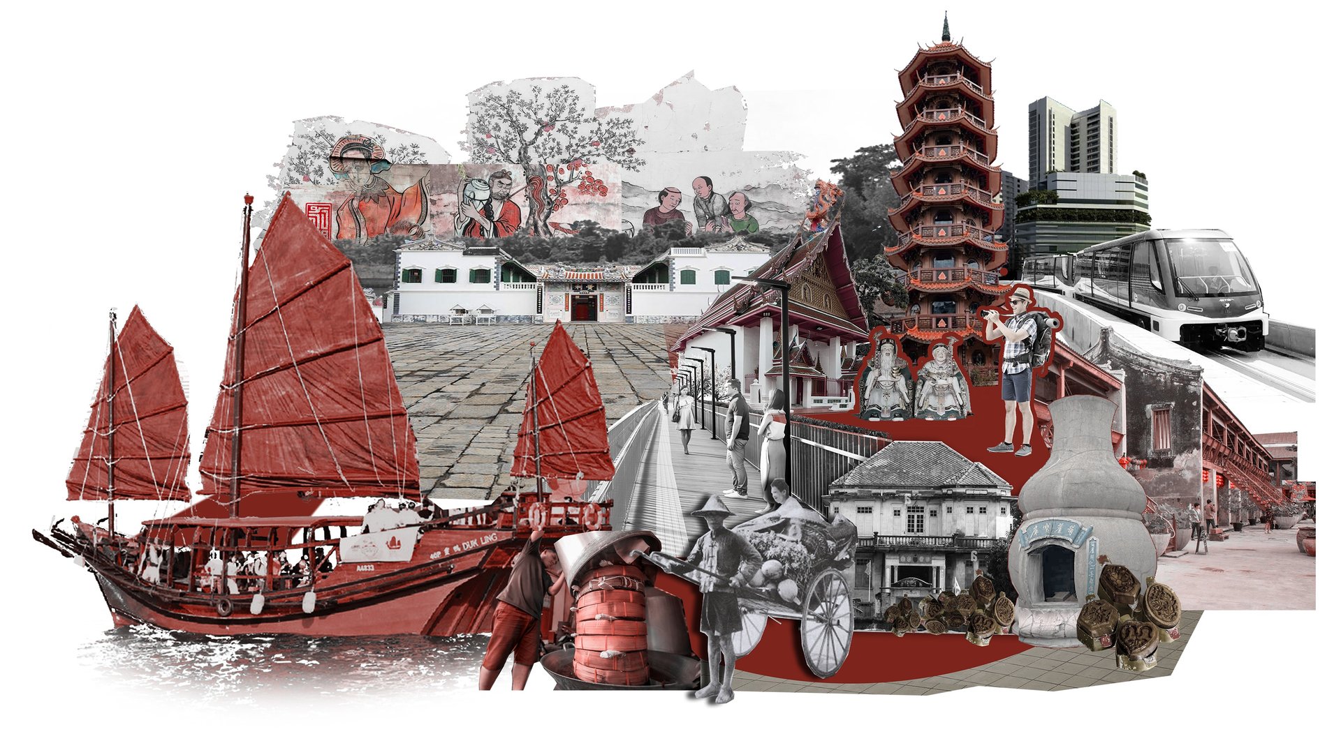
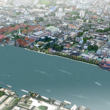
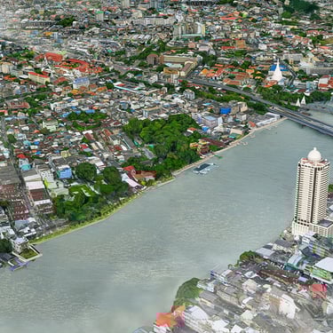
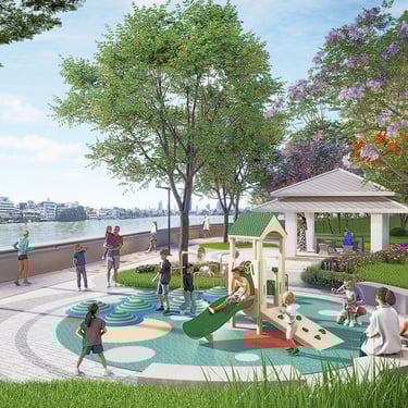
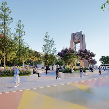
The urban renewal project for the Old Thonburi Area is a key strategic initiative to address the economic, social, and environmental impacts of Bangkok's rapid growth. It leverages the unique cultural potential and local wisdom of each neighborhood, prioritizing balanced development. This involves integrating infrastructure improvements with the preservation of cultural heritage sites, promoting community economic activities, and fostering strong community participation. The project aims to transform the old Thonburi district into a model of sustainable and livable urban development, enhancing the city's creative economic competitiveness and improving the quality of life for Bangkok residents.

Image
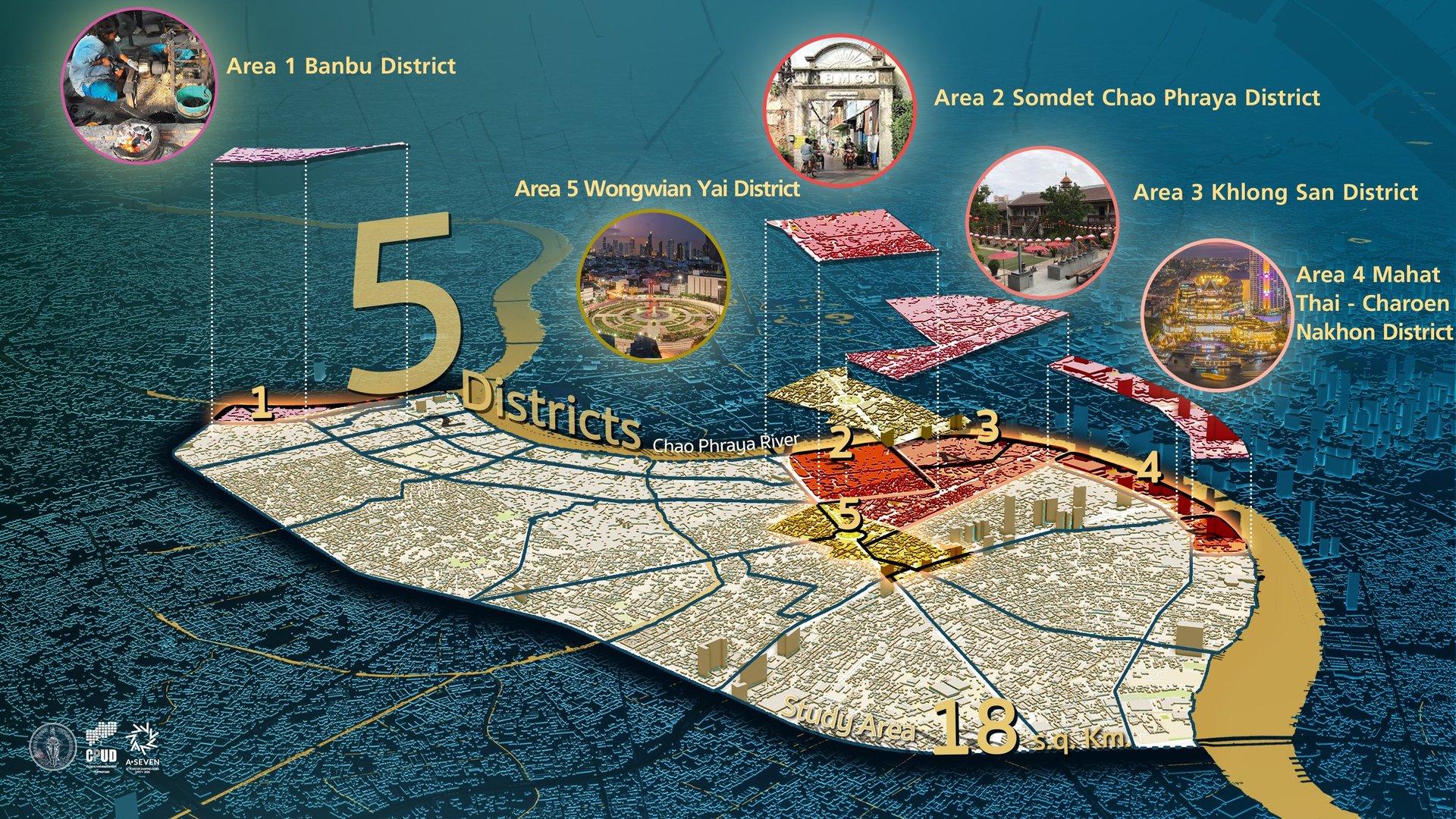
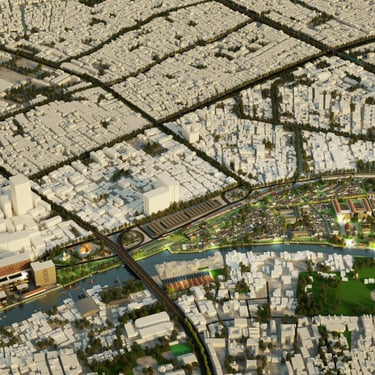
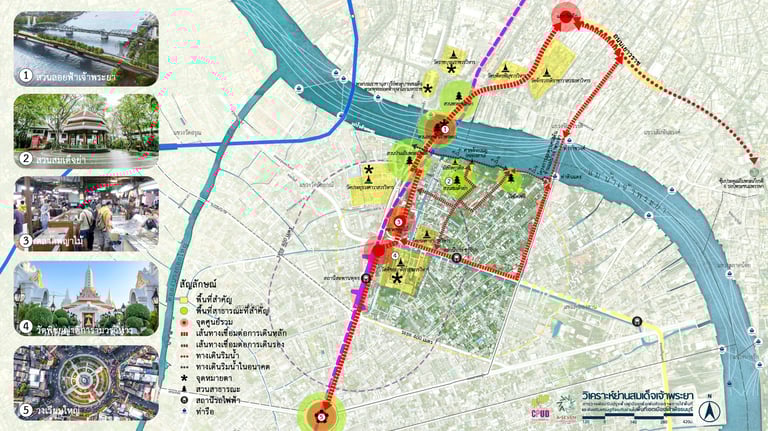
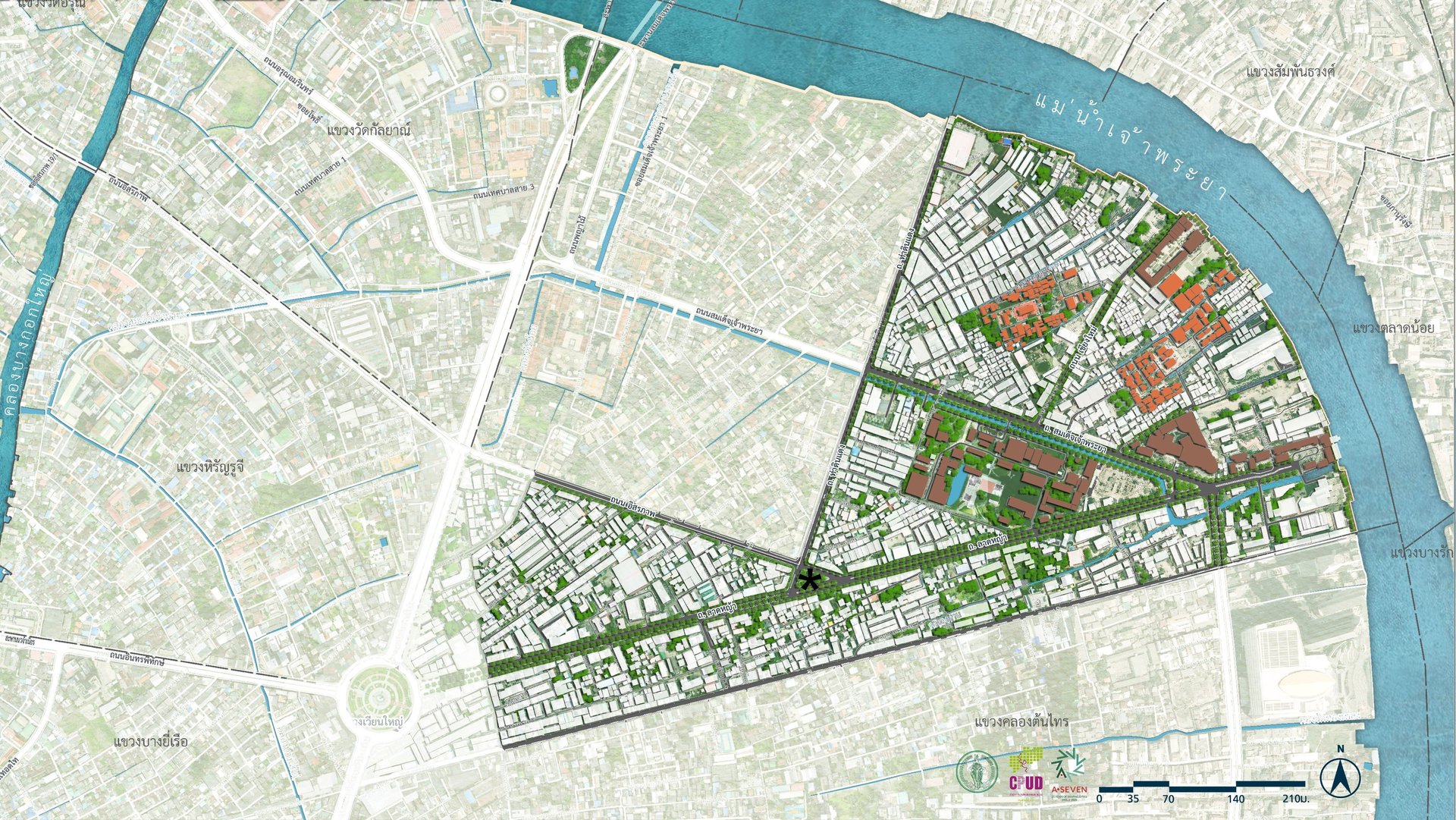
District Plan
The Strategic Master Plan for the Development, Improvement, and Revitalization of Neighborhood-Level Urban Areas in the Thonburi Riverside Old Town has the vision: "Thonburi Old Town: A Living Heritage City Harmonizing History, Innovation, and Sustainability to Foster an Enhanced Quality of Life for All." This plan utilizes the concept of developing and revitalizing the Thonburi Riverside Old Town area, aiming to make it a Living Heritage City that integrates the power of social, cultural, and economic diversity to create a new, balanced, and harmonious way of life. It also maintains the balance and reflects the cultural identity of the Thonburi Riverside Old Town, focusing not only on preserving important historical, architectural, or artistic areas but also on seamlessly connecting historical spaces from the past through the integration of green spaces with cultural heritage conservation. Furthermore, it drives the local creative economy by promoting innovation and learning to create economic opportunities and improve people's quality of life. Under this approach, the Thonburi Riverside Old Town area will grow alongside the original communities and new generations, who will jointly drive the city toward sustainability and make it a livable city for everyone. This will be achieved by connecting local wisdom with an advanced quality of life, under the balance of urban development and cultural roots.
The Strategic Master Plan for the Development, Improvement, and Revitalization of the Thonburi Side of the Old City is the creation of strategies, tactics, programs, and projects to enhance land use potential and promote neighborhood-level economies in the Thonburi side of the old city, in accordance with the vision, objectives, and goals. This is to achieve the objectives and goals of increasing land use potential, as well as promoting the neighborhood-level economy, by building collaborative networks across all sectors to drive sustainable urban development. This will result in job creation, cultural promotion based on social diversity, and improved living standards for the people. This is achieved by creating good opportunities for the city through learning processes, public participation, and the development of Bangkok. In the future, to keep pace with the rapidly changing city, the development strategy has been divided into 6 main strategies, comprising sub-strategies, targets, tactics, indicators, and programs.
Objectives of the project
1.To study, survey, and prepare a strategic master plan for the development, improvement, and urban regeneration at the district level in the historic urban area on the Thonburi side.
2.To prepare a district development plan (District Plan) and a site-specific urban action plan (Project Plan).
3.To design detailed projects for urban improvement and regeneration.
4.To prepare a project management plan for urban improvement and regeneration.
5.To study, survey, and compile a register of conserved buildings and cultural heritage sites within the historic Thonburi urban area.
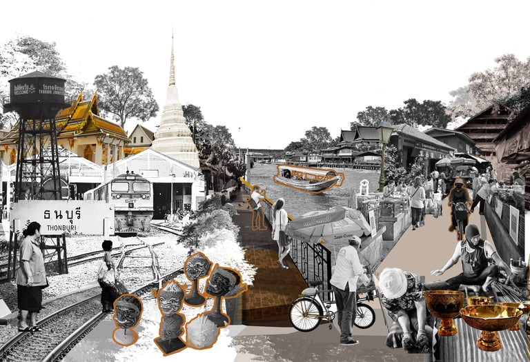
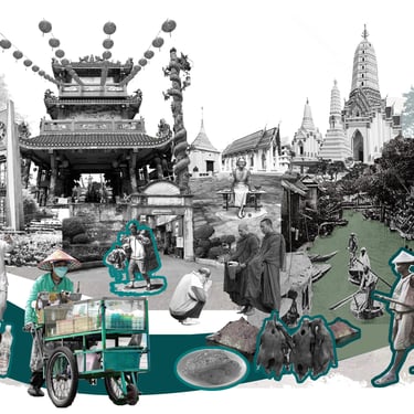
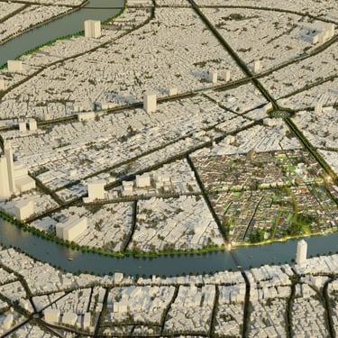
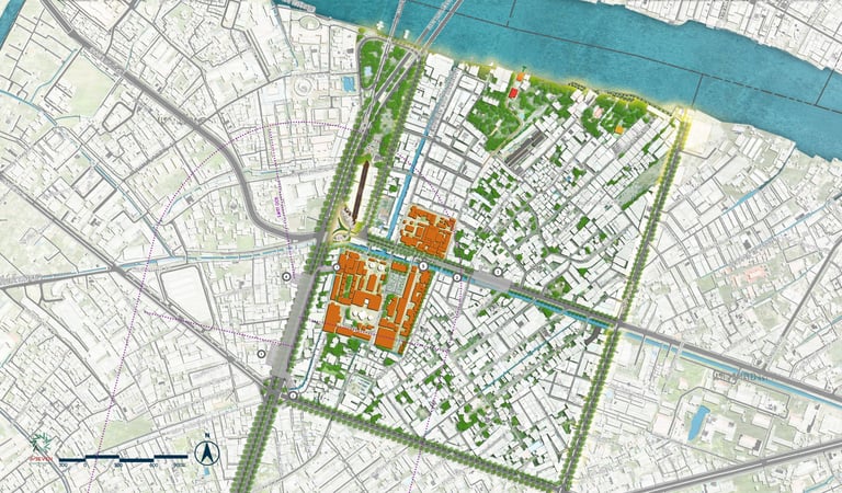
Banbu District
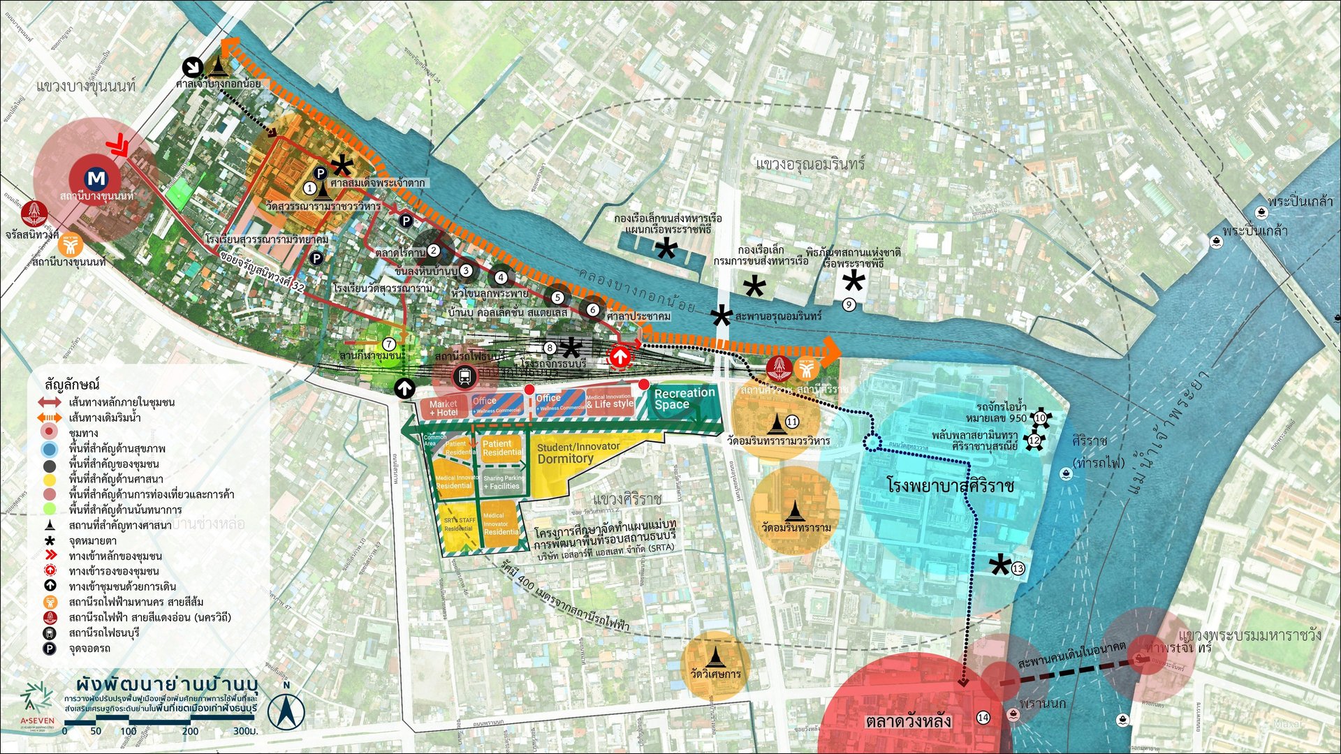
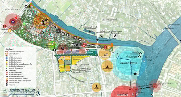
Site Analysis
Master Plan


4 DNA
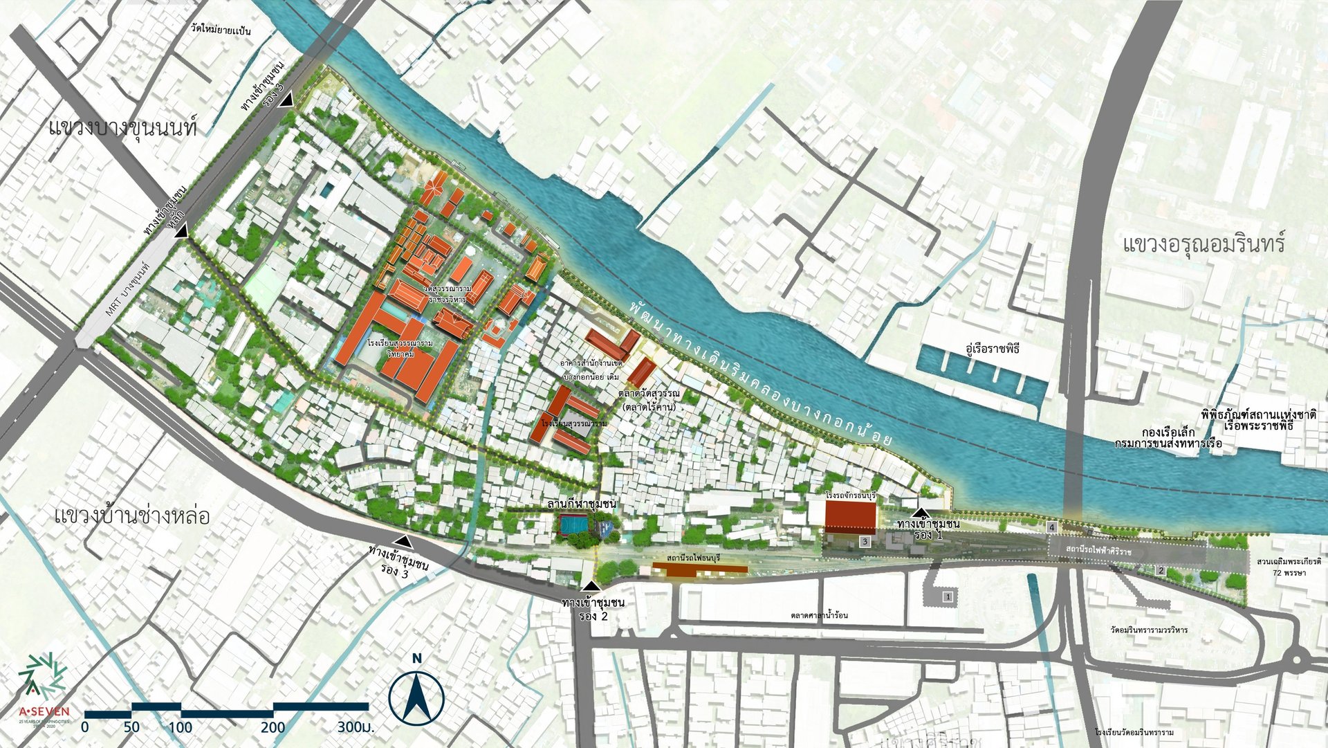
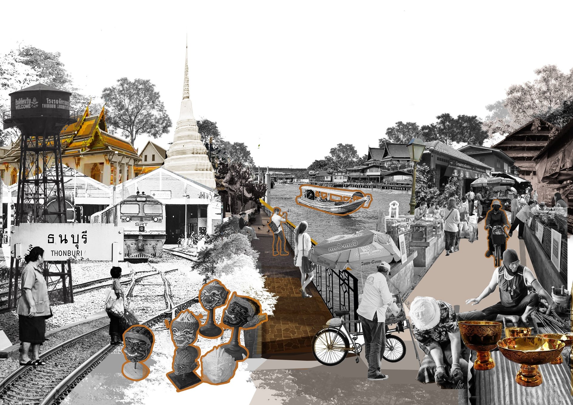
Ban Bu is an ancient community located on the south bank of the Bangkok Noi Canal, with a history spanning over 200 years. It is believed that the ancestors of the Ban Bu villagers migrated to settle in this area during the Second Fall of Ayutthaya in the year P. Professor 2310 by the group of immigrants, who were Ayutthaya artisans specializing in metalworking. Almost every household in Buket was engaged in the production of stone bowls since the past, which is considered a production wisdom passed down from generation to generation.
Due to the rising cost of raw materials used in the production of stone mortars, market demand has decreased over time. Additionally, the economy has not recovered, leading villagers to pursue other occupations. In the year P. Professor In 2006, a fire broke out within the community, causing damage to homes and leading some residents to move out. This resulted in more outsiders moving into the community, so that currently, the population of Ban Bu includes both original residents and people from outside the area living together. Therefore, the Ban Bu neighborhood is a culturally valuable area and an old community with physical, social, and cultural costs. These cultural assets are both tangible and intangible.
Symbol Design Based on Identity Study
Bangkok Noi Canal: Represents abundance and a way of life rooted in river-based communities.
Temple: Represents Wat Suwannaram, a temple located at the heart of the Ban Bu community.
Khan Long Hin (Stone-polished bowl): Represents the traditional stone-polished bowls of Ban Bu.
Market: Represents the “Rai Khan” market, a long-established community market with a history of over 80 years.
Thonburi Railway Station: Represents the history of rail transportation within the district.
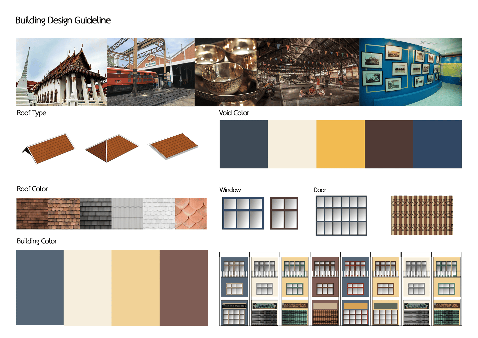
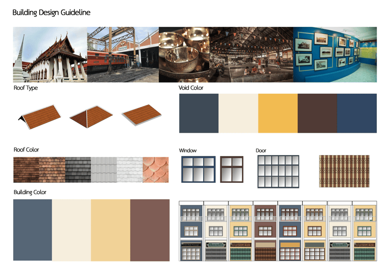
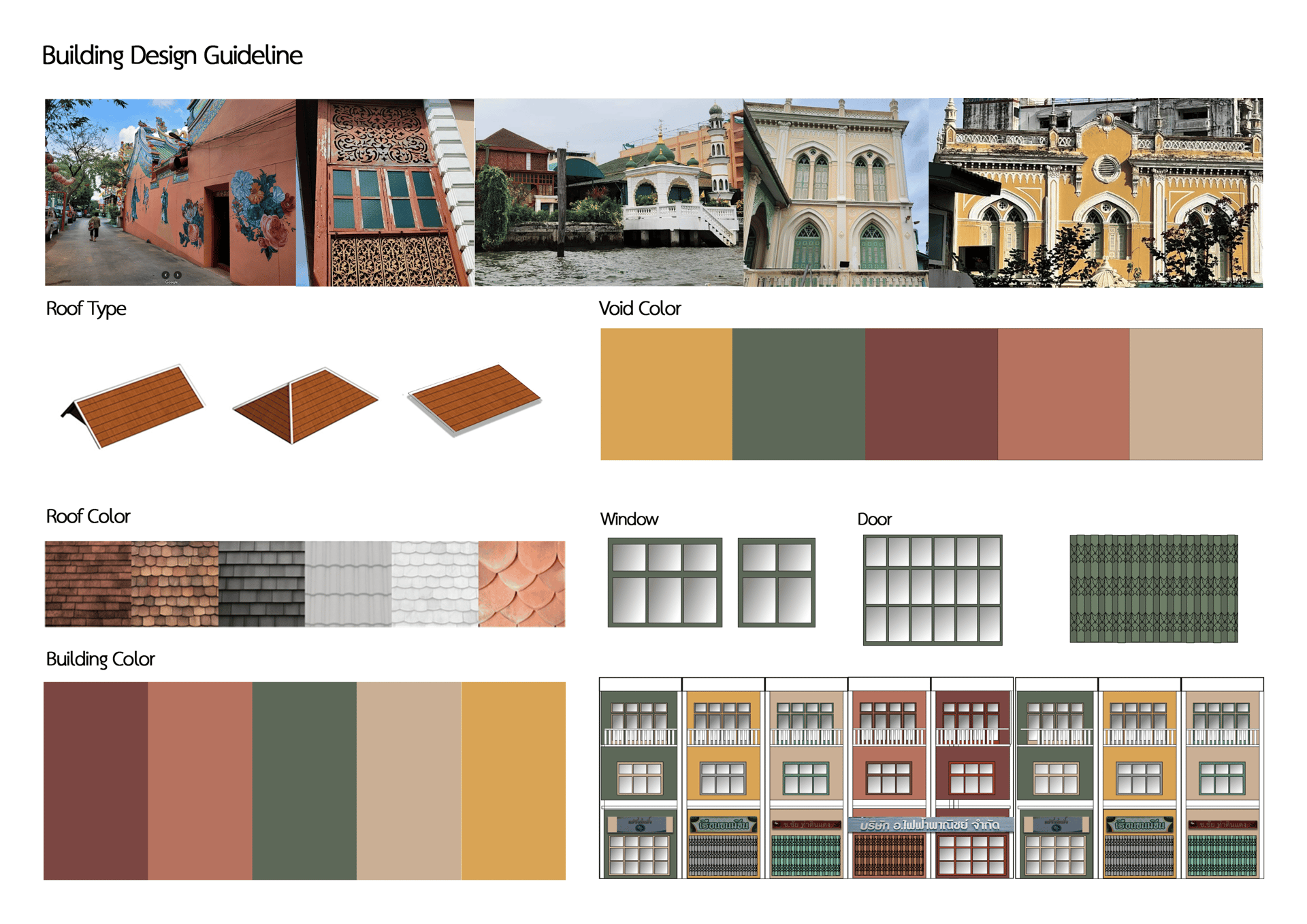
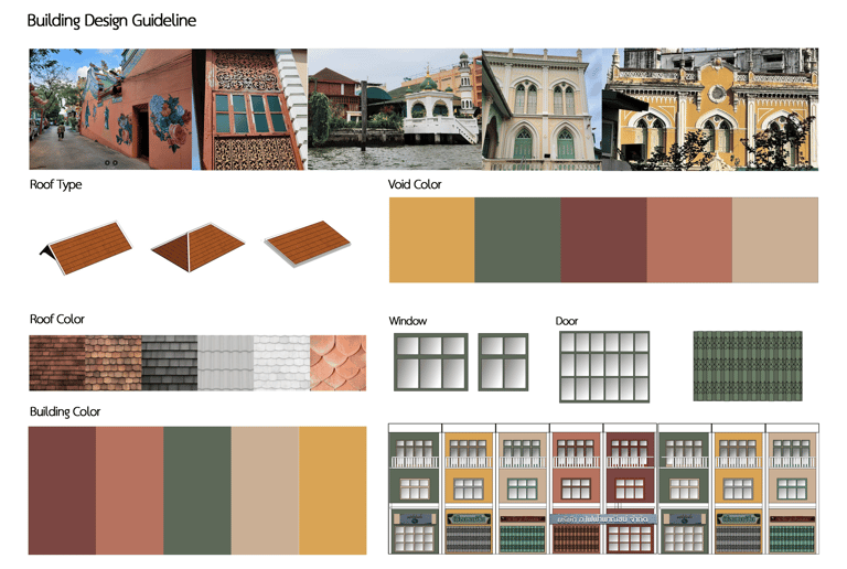
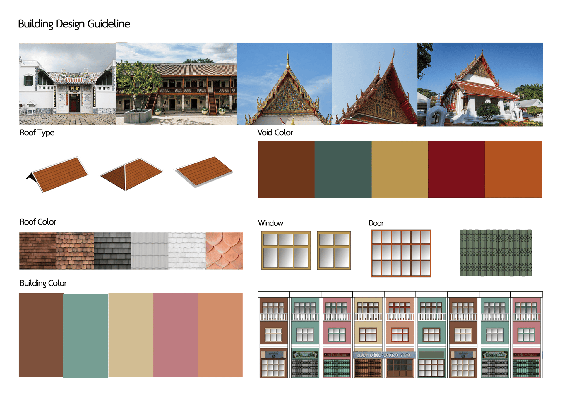
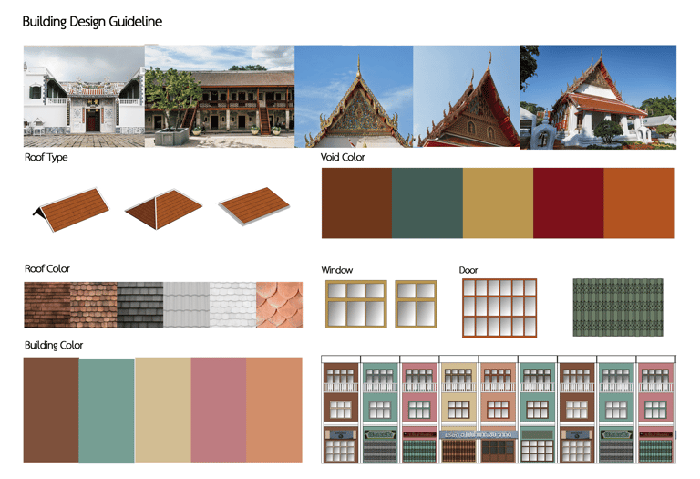
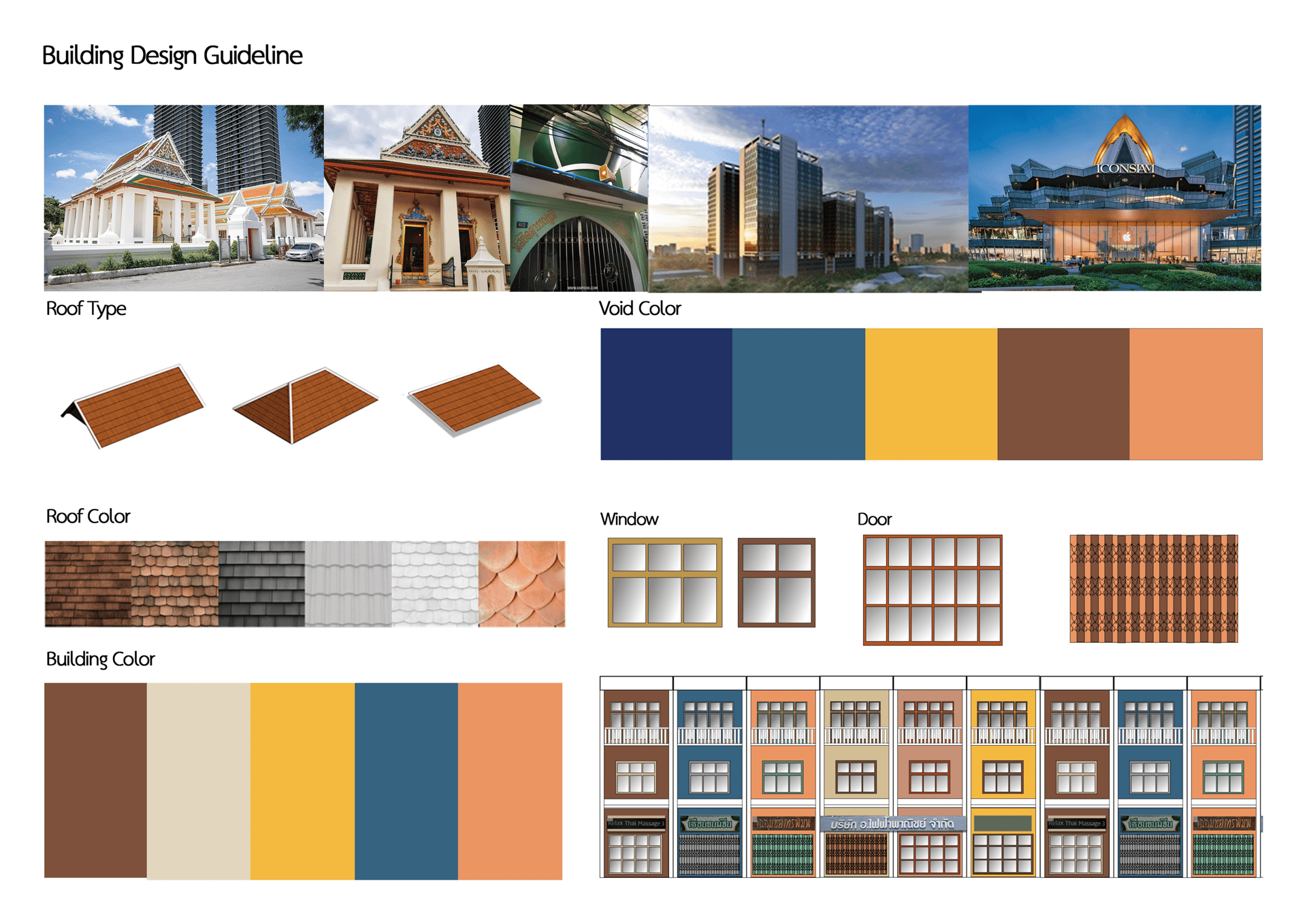
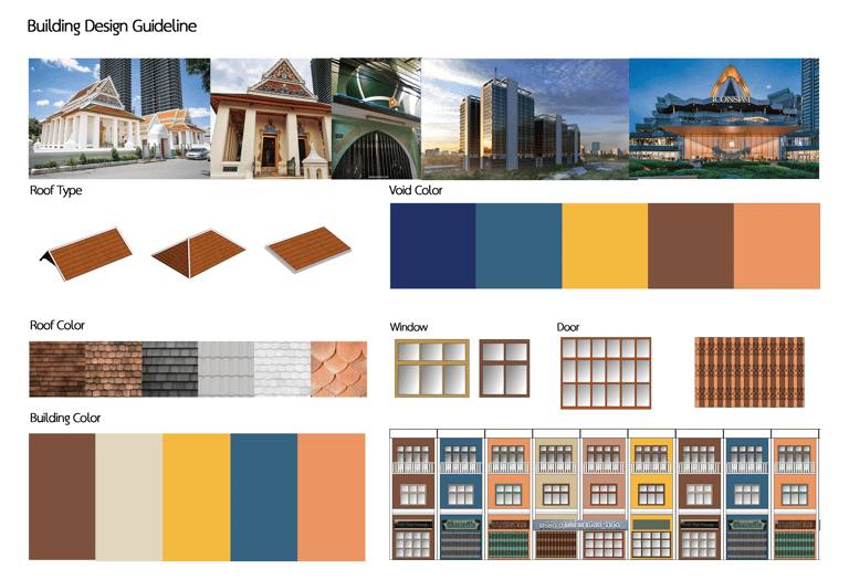
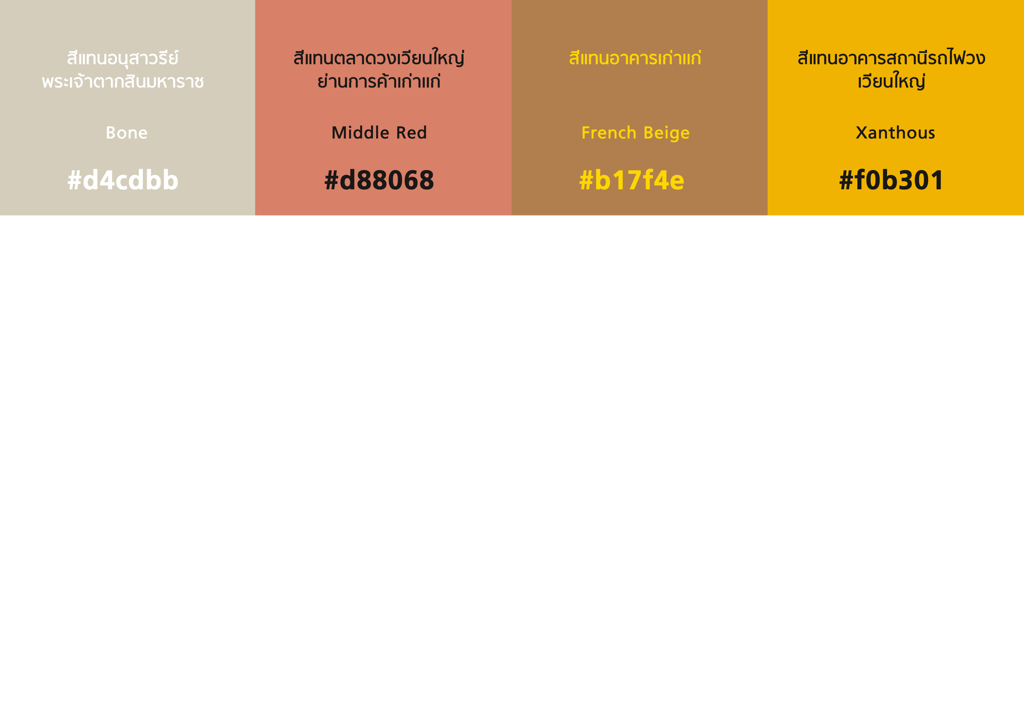
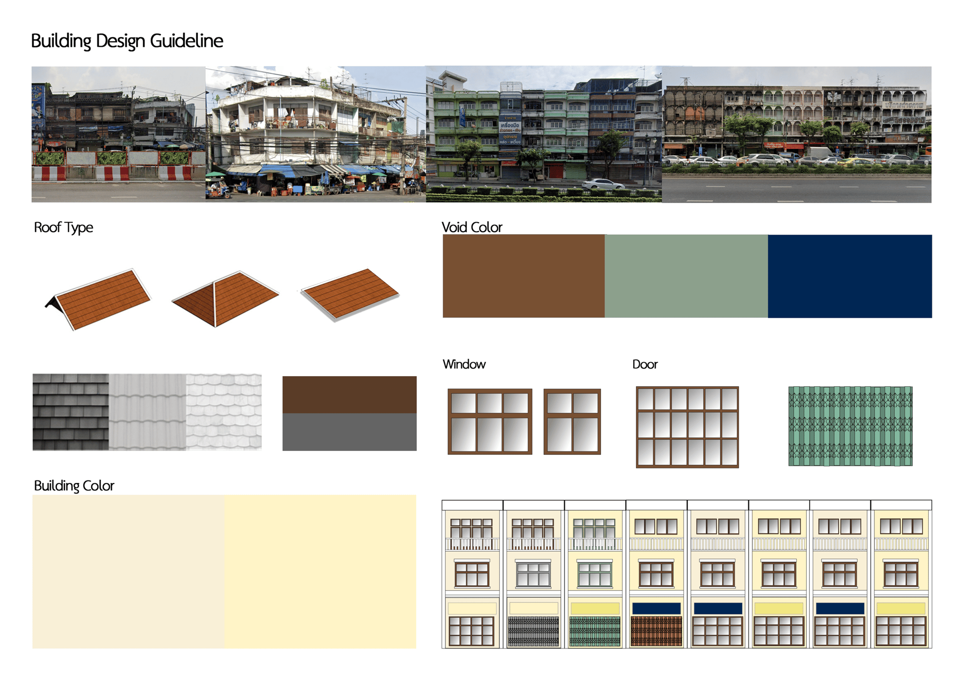
From a study of the architecture in the Ban Bu area, it was found that there are architectural elements that should be promoted to preserve the landscape, identity, and cultural heritage of the Ban Bu area. Architectural recommendations were made using the unique characteristics and identity of valuable buildings in the area, and color schemes were determined to create a memorable image of the Ban Bu area.
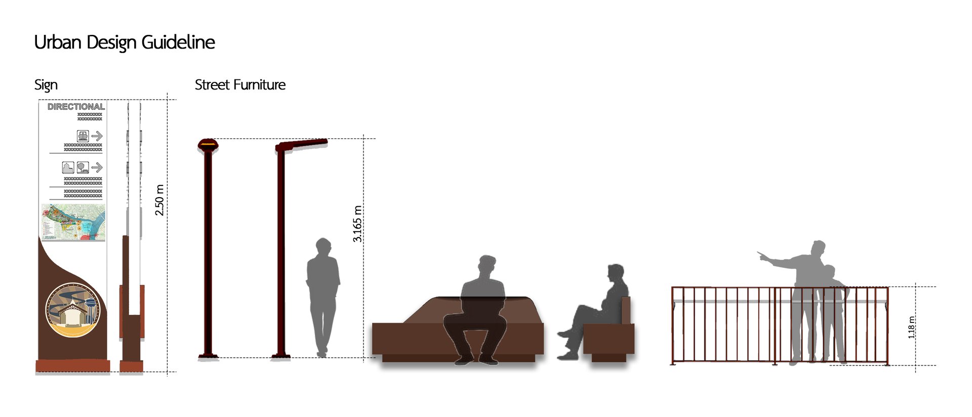
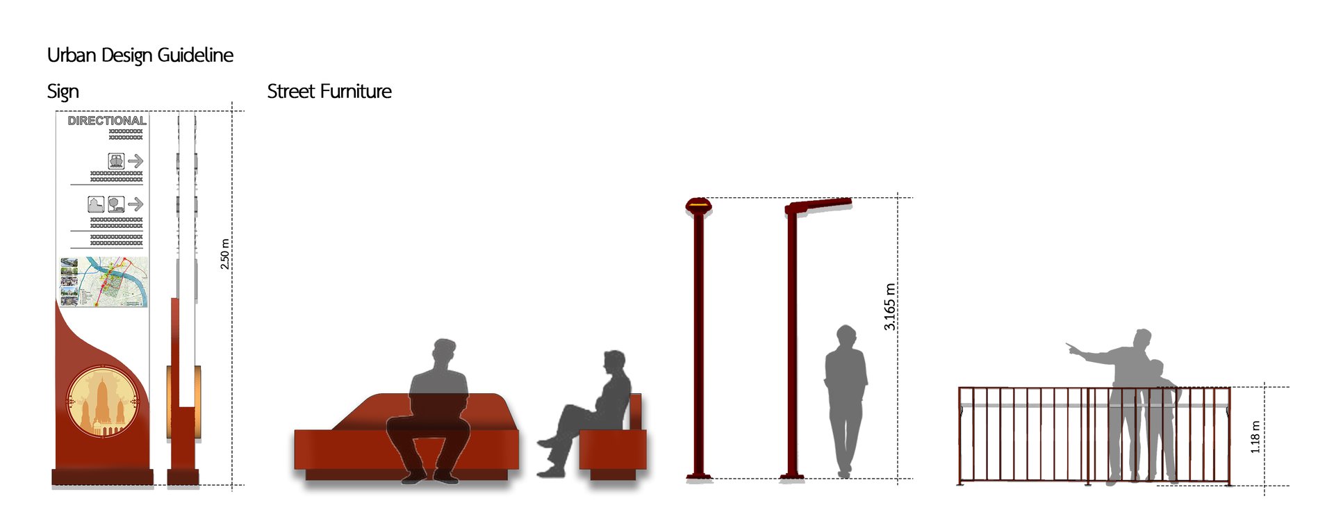
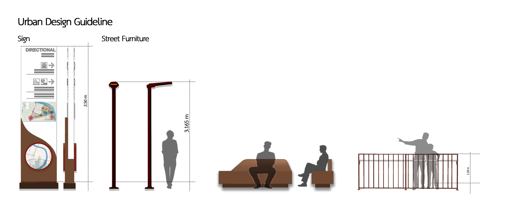
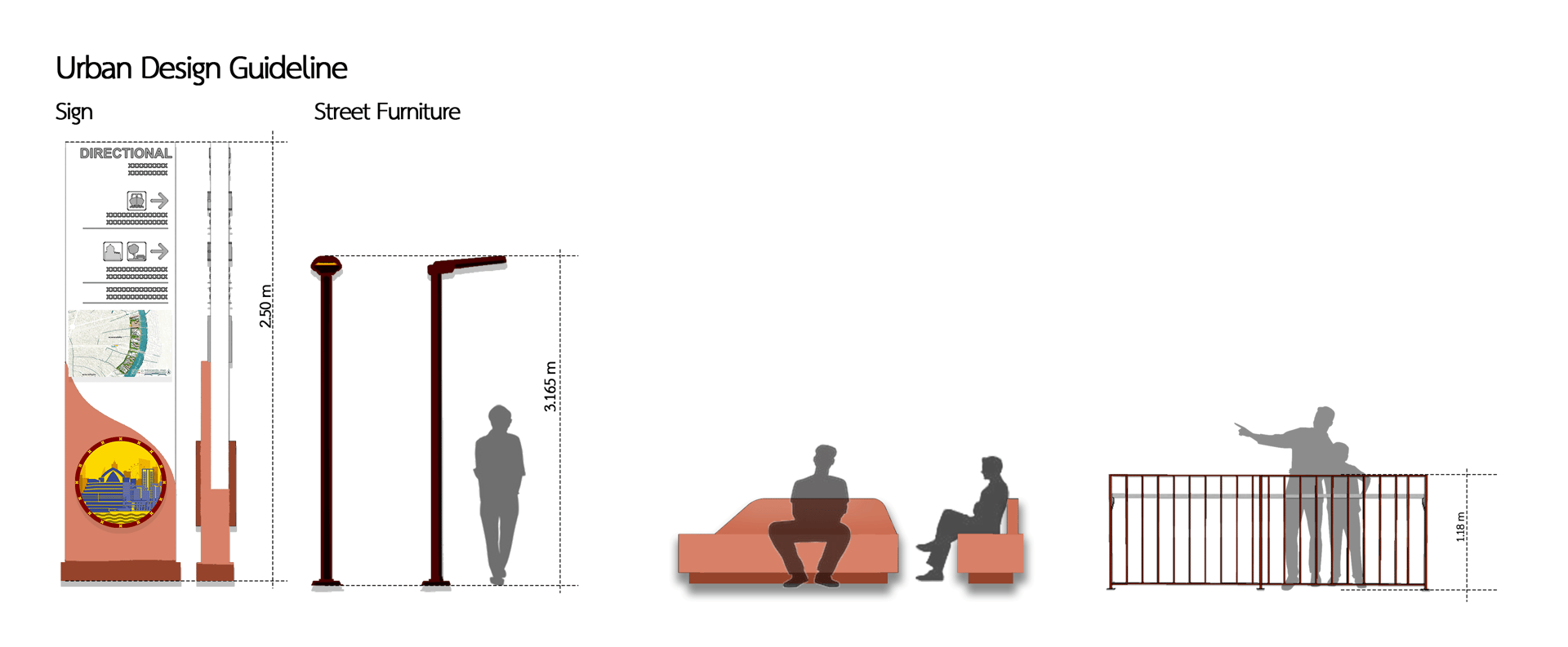
The Ban Bu area is connected to Bangkok's main transportation system, being close to the Blue Line (MRT) with the Itsaraphap and Bang Khun Non stations, which helps connect the area to the city center, connects to the water transport system, and is accessible by public transport such as buses. The main bus routes passing through the Siriraj area and the two-row cars within the community can be developed into a walking tourism area that promotes walking and cycling if appropriate infrastructure is developed. The Ban Bu area has traffic congestion problems because the roads in the Ban Bu area and around Siriraj are mostly narrow and cannot accommodate a large volume of vehicles. The sidewalks are narrow and discontinuous, making travel within the community inconvenient. The public transportation system does not cover all points; although there are trains and boats, accessing the stations from within the community is still difficult. There is a lack of parking, especially around Siriraj, leading to double parking problems. Physical constraints limit the expansion of roads or traffic routes, making them incapable of accommodating the increasing volume of vehicles. Infrastructure improvements that will take place must consider preserving the community's identity.
Bangkok Noi, Bangkok
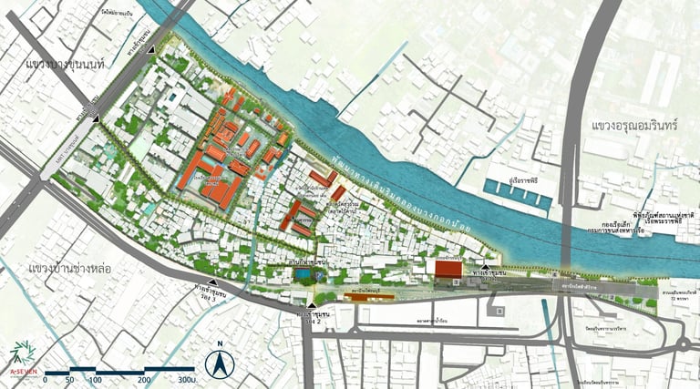
Somdet Chao Phraya District
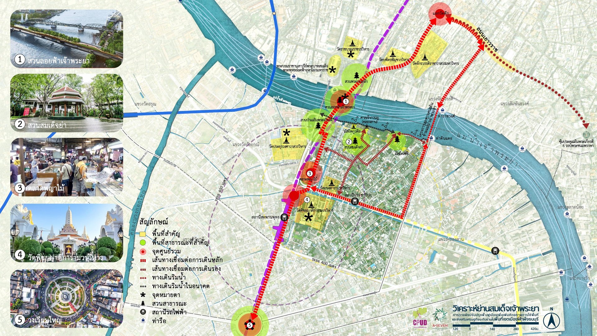

Site Analysis
Master Plan
4 DNA


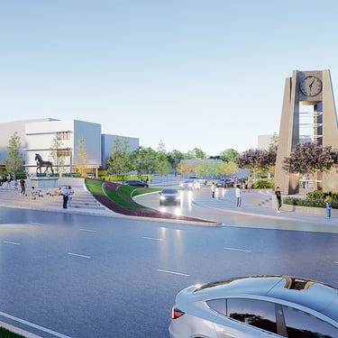
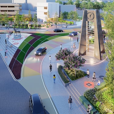
The Somdet Chaophraya area is a residential area located along the Chao Phraya River. It is a historic area with significant arts and culture, benefiting from the social and cultural capital inherent in the area, which can be leveraged for new creations. However, due to its location in a historic area, some parts of the area are restricted from development because of building height controls, which may affect future development. Regarding the internal transportation system, it lacks continuity and connection with other routes, especially with the main roads. Another significant problem in the area is the heavy traffic congestion during peak hours, particularly at the small clock tower roundabout. In the future, the arrival of the Purple Line (the MRT Chalong Ratchatham Line project) will make accessing the area easier, helping to reduce traffic congestion during peak hours. However, if these limitations can be addressed, the Somdet Chaophraya area will become even more livable due to the increase in public spaces and the complete integration of infrastructure to create a "Walkable City" that supports a high quality of life and accommodates the dynamics of changes in transportation and people's lifestyles in the future, which will help improve the quality of life and community economy.
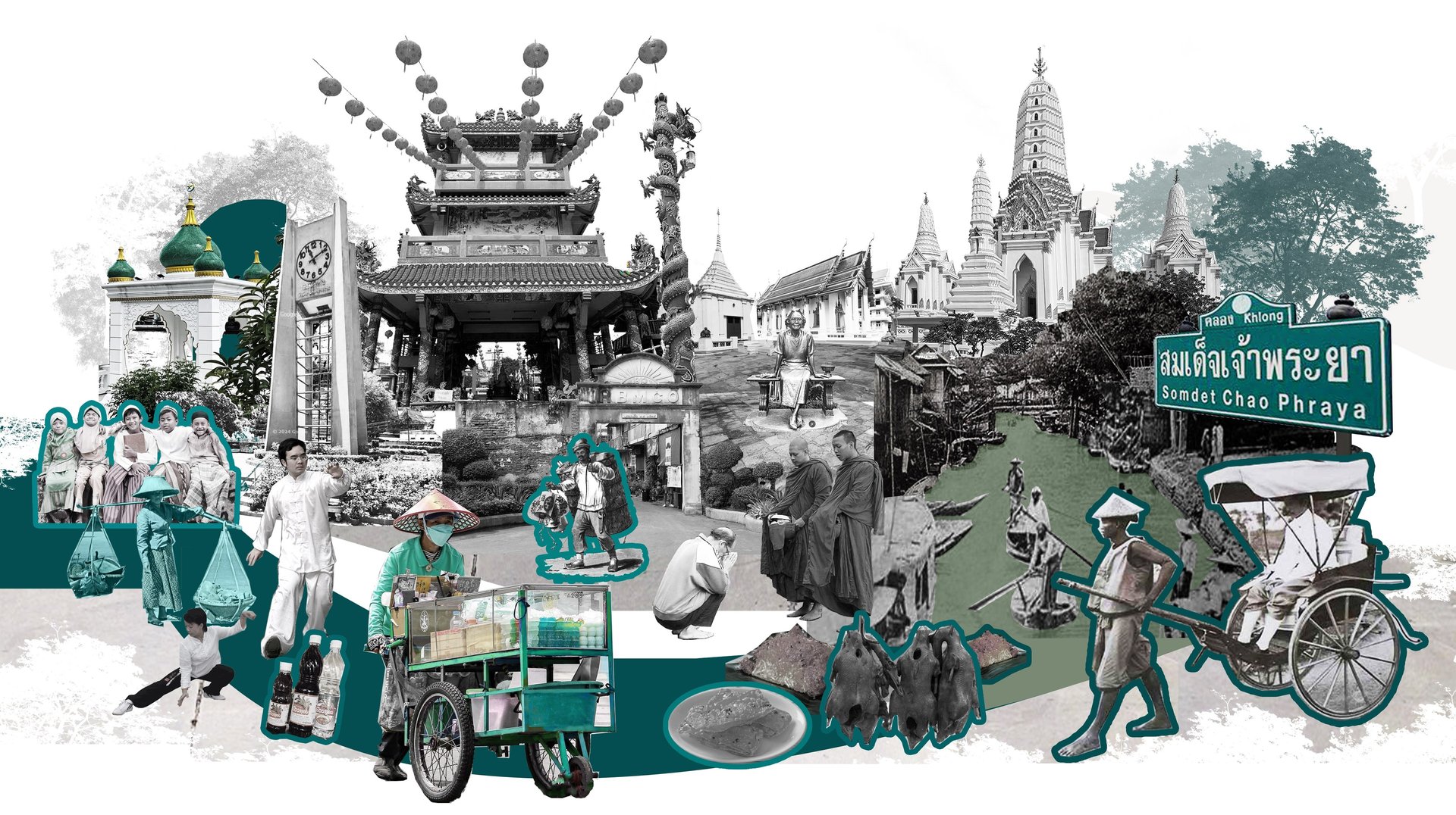
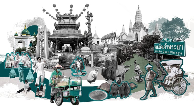
Symbol Design Based on Identity Study
Mosque: Represents the cultural significance of Kuwatil Islam Mosque and Sefee Mosque.
Phra Prang (Pagoda Spire): Represents the Phra Prang of Wat Phichaiyatkaram.
Chinese Shrine: Represents Guan Yu Shrine and Chao Pho Suea Shrine.
Khlong San, Bangkok
From a study of the architecture in the Somdej Chao Phraya area, it was found that there are architectural elements that should be promoted to preserve the landscape, identity, and cultural heritage of the Somdej Chao Phraya area. Architectural recommendations were developed based on the identity derived from the colors and unique building styles in the area, with the aim of creating a unique district.
The Somdet Chao Phraya area offers transportation options by both land (road) and water (Chao Phraya River passenger boats). The area's terrain is suitable for promoting cultural walking. The roads within the area are narrow and have parked cars obstructing traffic, especially during school or hospital opening and closing times. The connection between the piers and the bus or rail systems is not continuous. The community has a limited number of busses passing thru the area, and there are no clear bus stops. Parking is insufficient, leading to double parking or parking on sidewalks. The roads are narrow, and some routes are alleys that cannot accommodate large vehicles or busses. The sidewalks are not continuous, and some sections have obstacles. Improving transportation infrastructure must consider the area's identity; it is not easy to widen roads or build new structures.
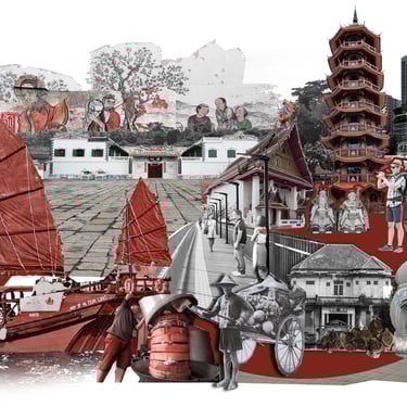
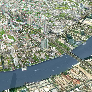
Khlong San District
Site Analysis
Master Plan
4 DNA


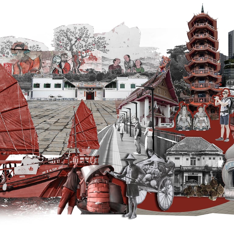
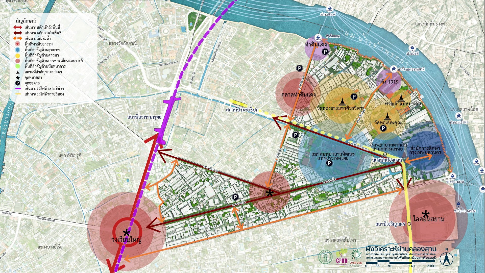
The Khlong San district, a residential area located along the Chao Phraya River and extending to Wongwian Yai, with Lat Ya Road as the main thoroughfare, is a historic district with significant arts and culture. It features old warehouse and storage buildings that can be repurposed into charming and unique residential and art studio spaces, representing a valuable cultural asset. Physically, the area has the potential for high-density mixed-use development due to the presence of suitable land along the Chao Phraya River and the Gold Line Skytrain. The Khlong San station is located within the district and is also close to the MRT Purple Line (Chalong Ratchatham Line) Wongwian Yai station, making it suitable for high-density mixed-use development based on the concept of Transit-Oriented Development (TOD). This can lead to the development of a significant economic district in Thonburi. The presence of the Gold Line Skytrain Khlong San station increases travel options, accessibility, and connectivity to external areas. However, if these limitations can be addressed, the Khlong San district will become even more livable due to an increase in public spaces, appropriate land use density, and comprehensive infrastructure connectivity, creating a "Walkable City" that supports a high quality of life and accommodates the dynamics of future changes in transportation and people's lifestyles. This will help promote the district's economy more effectively.
Symbol Design Based on Identity Study
Chao Phraya River: Represents the way of life of communities located along the Chao Phraya River.
Temple: Represents Wat Thong Thammachat and Wat Thong Noppakhun.
Hospital: Represents Somdet Chao Phraya Hospital, located along the Chao Phraya River.
Chinese Architecture: Represents Lhong 1919.
Khlong San, Bangkok
From a study of the architecture in the Khlong San area, it was found that Khlong San has many buildings of architectural value, such as Wat Thong Thammachat, Wat Thong Noppakhun, and valuable Chinese architecture. These architectural elements should be promoted to preserve the landscape, identity, and cultural heritage of the Khlong San area.
The Klong San area has good transportation potential due to its network of main roads and efficient public transportation systems. It has important roads such as Prachathipok Road, Charoen Nakhon Road, and Itsaraphap Road, which can handle high traffic volumes. It also has convenient access to the BTS Skytrain, which connects the area to other important districts. Other public transportation systems, such as busses, also provide good connectivity. There are various options for accessing the area. The Klong San area has traffic congestion problems, especially during the evening rush hour, such as on Prachathipok Road, which has high traffic volume and is heavily congested. Problems from infrastructure construction, such as the construction of the Red Line Skytrain, which causes some traffic lanes to be closed, leading to congestion in the area. The current infrastructure is insufficient for use. Limited infrastructure restricts the expansion of roads or travel routes due to community growth in the area.
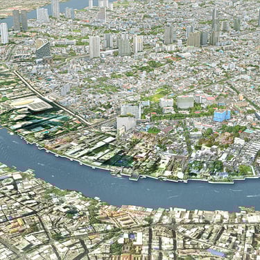
Mahat Thai District

Site Analysis
Master Plan
4 DNA


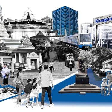
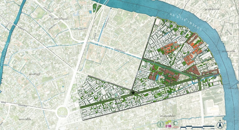
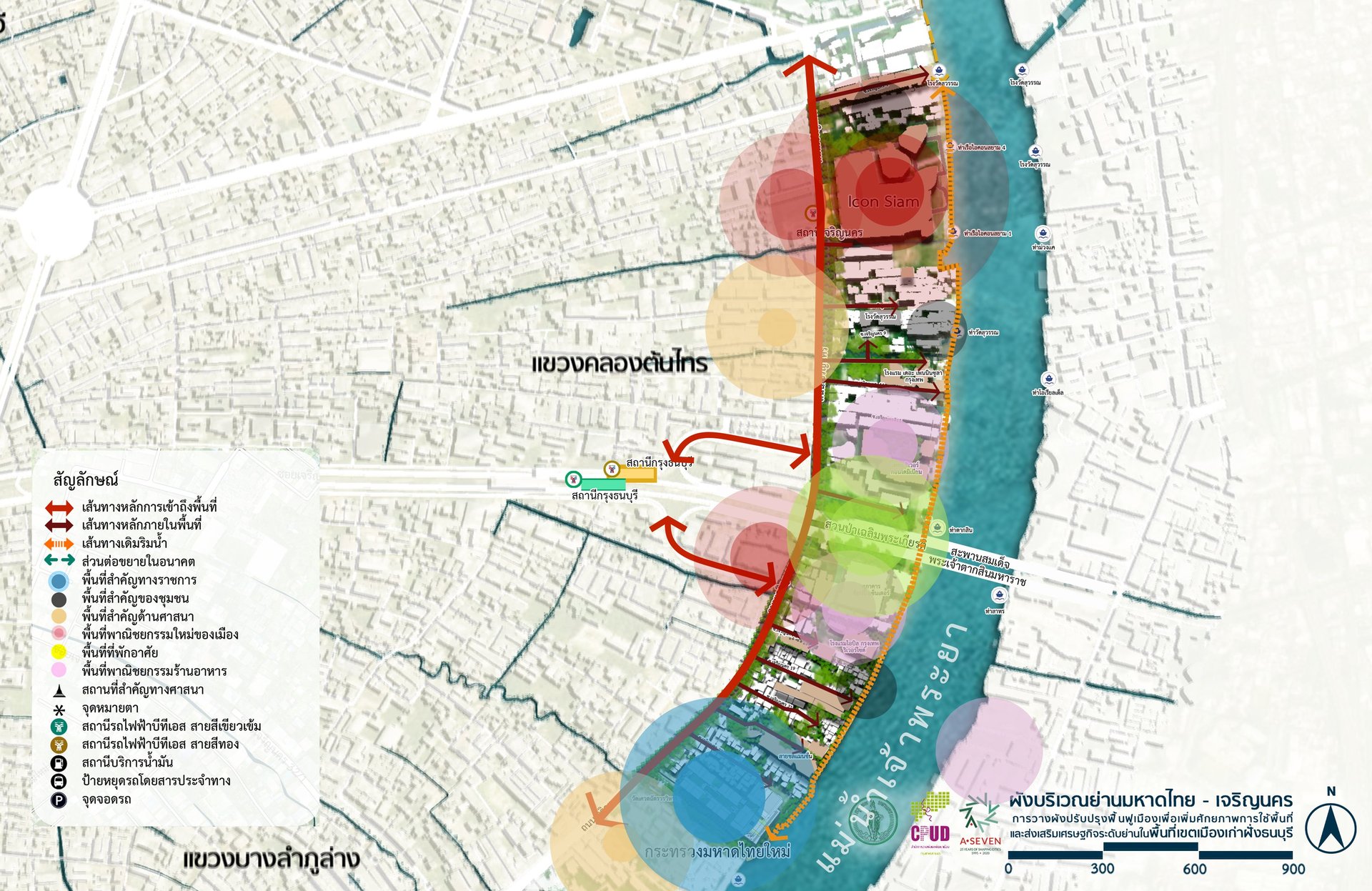
The Mahatthai - Charoen Nakhon area is characterized as a residential and commercial district located along the Chao Phraya River. Its northern boundary borders Charoen Nakhon 1 Road, and its southern boundary borders Khlong Bang Lamphu Lang. In terms of transportation, Charoen Nakhon Road is the main road in the area, while the various alleys are small, narrow, dead-end streets that lack connectivity. Most of the land within the area is used for high-density mixed-use purposes, such as condominiums, hotels, and shopping malls, resulting in heavy traffic congestion. However, from the other side of the Chao Phraya River, there is a beautiful view of the Sathon area, which is one of the business and economic centers on the Phra Nakhon side. This makes the scenery in this area very prominent. The importance of this area lies not only in its potential as a riverside location on the Chao Phraya River but also in the future completion of the new Ministry of Interior building, which is expected to be finished in the year P. Professor 2569 will be a significant draw for diverse space usage demands and activities. The influx of employes and government officials using the building will significantly increase the demand for housing in the area. Therefore, it is necessary to develop a neighborhood plan to address the physical problems and limitations of the area in order to accommodate future high-density space usage. This will ensure that the area has sufficient potential to become the new residential and employment center along the Chao Phraya River on the Thonburi side.
Symbol Design Based on Identity Study
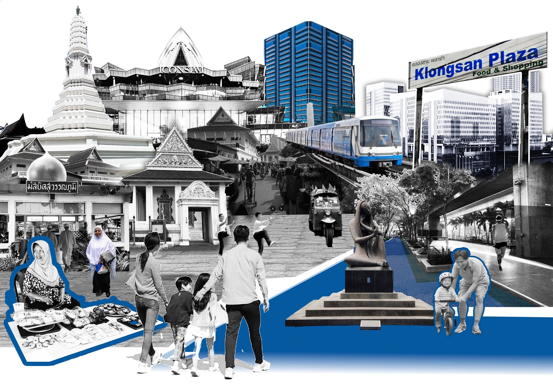
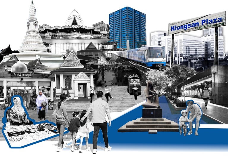
Historic Sites: Represent historic buildings in the area, conveying past settlements and traditional ways of life.
Ministry of Interior: Represents the new Ministry of Interior complex under construction in the area, which will establish the district’s future role as a government precinct.
Wat Sawetachat Worawihan: Represents an important religious landmark in the area.
Food District: Represents commercial areas and clusters of shops.
Restaurants: Represent local shops and dining establishments within the district.
Khlong San, Bangkok
From a study of the architecture in the Mahathai - Charoen Nakhon area, it was found that the area has architectural elements that should be promoted to create a clear identity for the neighborhood. In the future, this area will become a government and waterfront commercial space with increased economic activity. Therefore, it is necessary to propose design and development guidelines for new buildings to have a unique character and create a memorable image for the neighborhood.
The Mahathai - Charoen Nakhon area is connected to the public transportation system via the Gold Line Skytrain, Charoen Nakhon Station, which connects to BTS Krung Thonburi Station and Klong Sarn Pier. The proximity to Klong Sarn Pier allows passengers to use the Chao Phraya Express Boat service, making it a good travel option. Some areas have good pedestrian walkways, especially in the area connected to the ICONSIAM shopping mall.
Traffic is heavy during business hours and peak hours, especially near BTS stations, ICONSIAM, and other key locations. Areas near schools or hospitals experience high levels of congestion, particularly during opening and closing times. Travel from the train station to areas within the community remains inconvenient due to a lack of clear connections. Sidewalks in some areas are narrow and filled with obstacles such as utility poles and vendor stalls, forcing pedestrians to walk on the road alongside cars and motorcycles. Expanding or improving transportation infrastructure in some areas is difficult due to the old structures and relatively cramped urban layout.
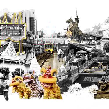
Wongwian Yai District

Site Analysis
Master Plan
4 DNA


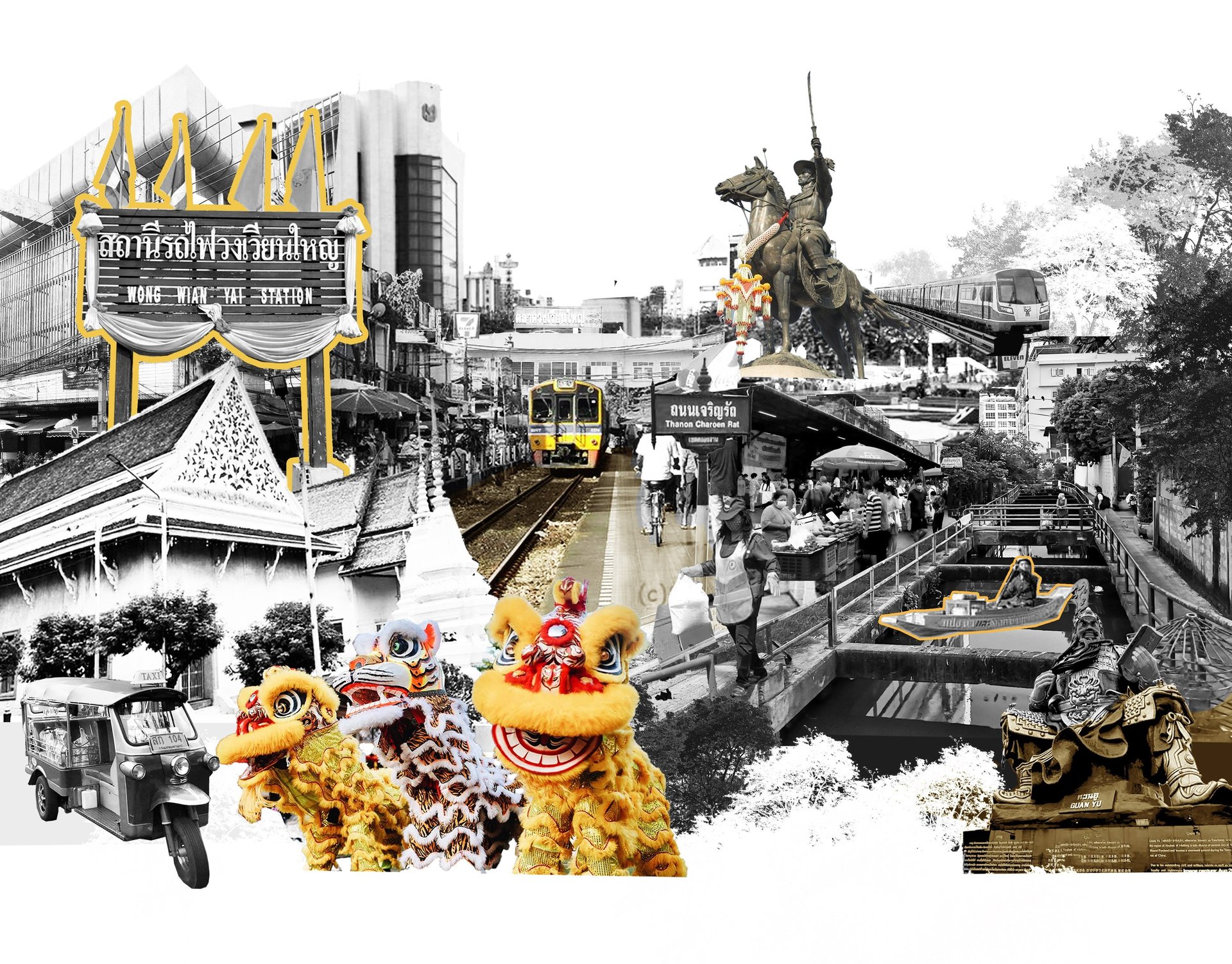
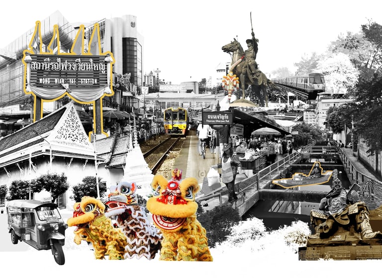
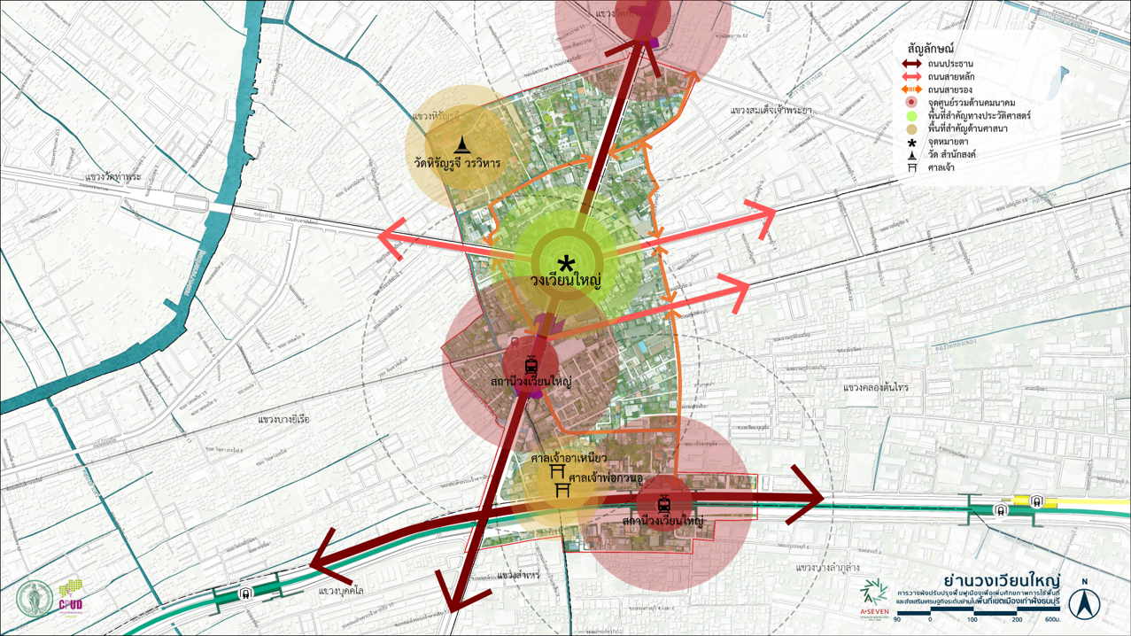
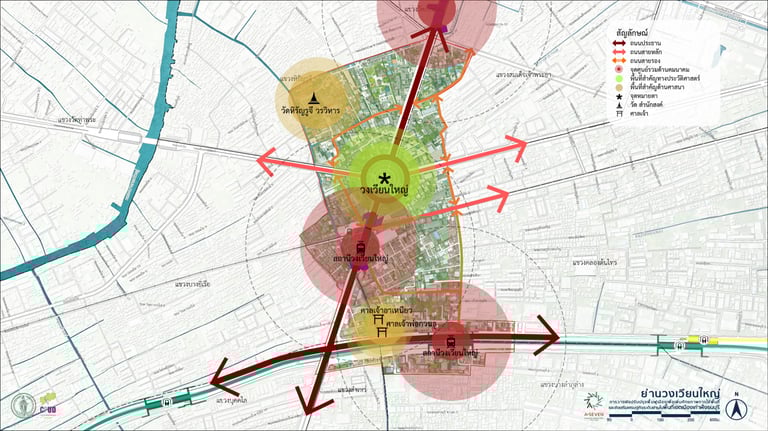
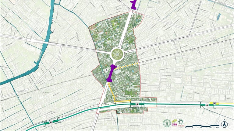
The Wongwian Yai area is like the central hub of the Thonburi side, connecting to the Phra Nakhon side via the Phra Phuttha Yodfa Bridge and the Phra Pokklao Bridge. The Wongwian Yai area also serves as the first gateway to Bangkok from the west. The area surrounding the project is primarily residential and commercial, with significant landmarks. The Wongwian Yai area is considered one of the historically and culturally significant areas on the Thonburi side, serving as a transportation and trade hub in the past. It plays a crucial role in connecting various areas through major roads such as Lat Ya Road, Prachathipok Road, and Taksin Road, which are surrounded by old markets, traditional shops, and historic communities. The development of infrastructure and transportation systems is leading to changes in the Wongwian Yai area. The arrival of the Green and Purple BTS lines, with a major station located within the area, has made Wongwian Yai a transportation hub and a strategic point attracting investment from both the public and private sectors. In the south, around Wongwian Yai station, efficient urban or area development around the mass transit station, or TOD (Transit-Oriented Development), is expected to occur in the future. Currently, the Wongwian Yai area reflects a city in transition from the past to the future, with infrastructure systems, real estate investment, and a renewed appreciation for local culture. With good urban planning, the Wongwian Yai area could not only be a physical connection point for the city but also a model for balanced and sustainable urban growth in the future.
Symbol Design Based on Identity Study
King Taksin the Great Monument: Represents reverence for King Taksin the Great as the restorer of Thai independence after the fall of Ayutthaya.
Commercial Area: Represents Wongwian Yai Market, a historic trading district on the Thonburi side.
Historic Wongwian Yai Community: Represents old buildings in the district located along Charoen Rat Road and Lat Ya Road.
Historical Transportation: Represents Wongwian Yai Railway Station, which has served as a key access route for people in the area from the past to the present.
Khlong San, Bangkok
From a study of the architecture in the Wongwian Yai area, it was found that the area has large commercial buildings, including department stores, cinemas, and train station buildings. The characteristics of these buildings contribute to architectural elements that should be promoted to create a clear identity for the area. In the future, the commercial center on the Thonburi side will generate new economic activity, so it is necessary to propose design and development guidelines for new buildings to have a unique character, creating a memorable image for the area and accommodating the large number of people who will be visiting.
The Wongwian Yai area has an efficient network of main roads and public transportation systems, including important roads such as Prachathipok Road, Itsaraphap Road, and Somdet Phra Chao Taksin Road, which handle high traffic volumes. Access to the mass transit system is available, making it easier to connect to other important areas in the district, especially near the BTS Wong wian Yai station. Other public transportation systems, such as busses and small four-wheeled vehicles, also provide good connectivity. The main problems in the Wong wian Yai area are traffic congestion, especially during peak hours in the morning and evening, such as on Prachathipok Road and Somdet Phra Chao Taksin Road, where traffic volume is high and severely congested. Problems from infrastructure construction, such as the Purple Line construction, have reduced traffic lanes on Somdet Phra Chao Taksin Road, leading to traffic congestion in the area. Infrastructure for accessibility has not been developed to cover the entire area, with a number of blind spots that are inaccessible. The high density of buildings limits the ability to widen roads or traffic routes. Some land may need to be expropriated to install infrastructure that aligns with future development. Infrastructure improvements must consider preserving the community's identity to prevent development from destroying the area's unique character and originality.
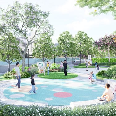
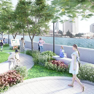
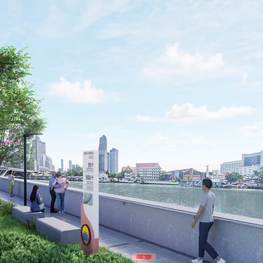
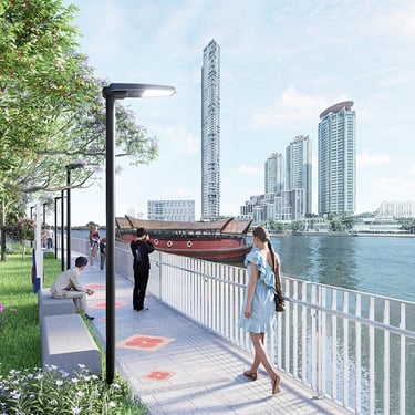
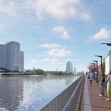
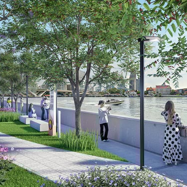
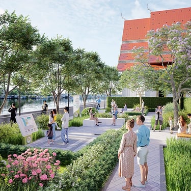
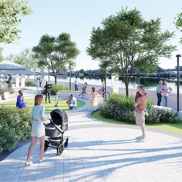
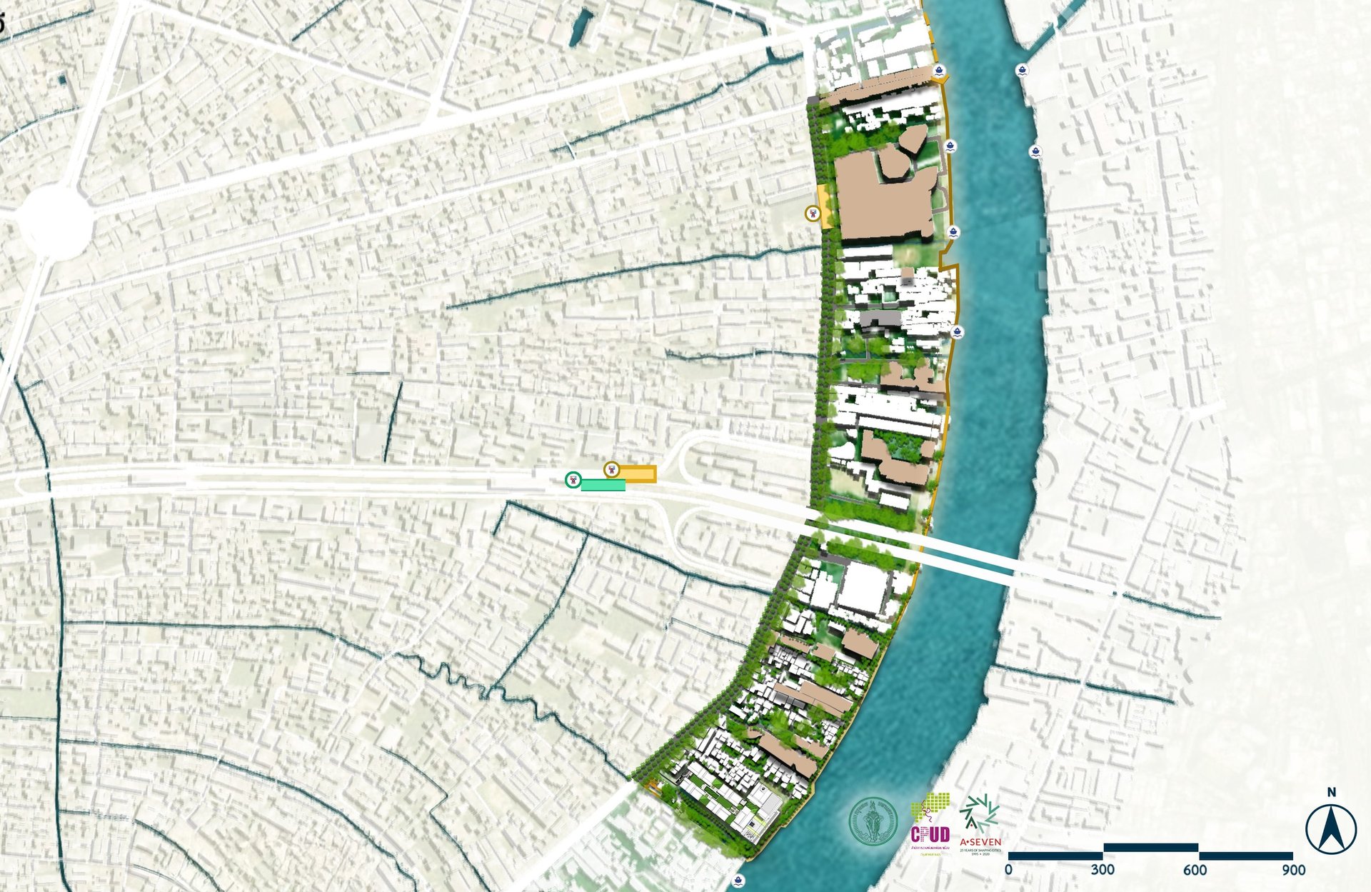
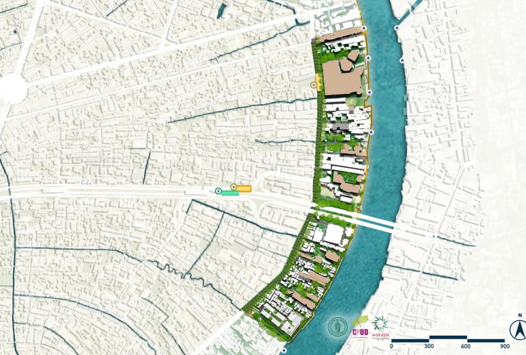
Area 4 The Chao Phraya Riverfront Landscape Improvement Project, from Siriraj Hospital to Wat Kanlayanamit Woramahawihan
Area 5 The Chao Phraya Riverfront Landscape Improvement Project, from Tha Din Daeng - Charoen Nakhon 1
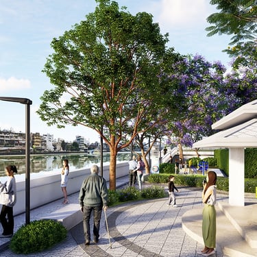
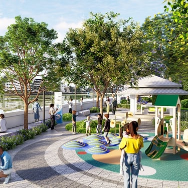
Area 6 The Chao Phraya Riverfront Landscape Improvement Project, from Charoen Nakhon 1 - Rama Three Bridge
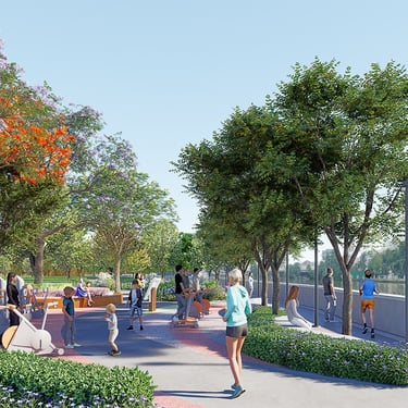
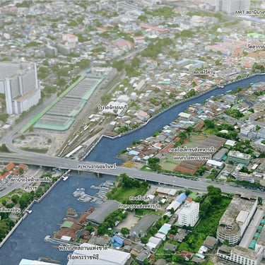
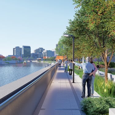
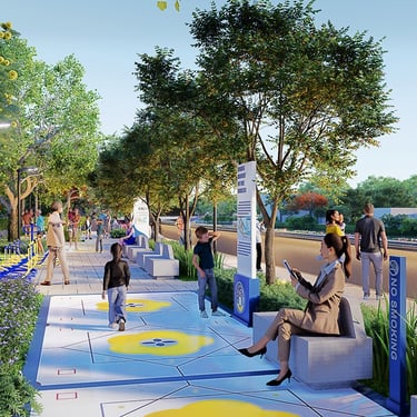
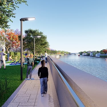
Area 1 The Bangkok Noi Canal Landscape Improvement Project, from Khlong Bangkok Noi Bridge to Siriraj Hospital.
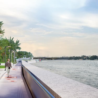
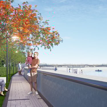
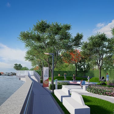
Area 2 The Chao Phraya Riverfront Landscape Improvement Project, from Phra Phutthayotfa Bridge - Tha Din Daeng
Area 3 The Chao Phraya Riverfront Landscape Improvement Project, from Charoen Nakhon 1 - Khlong Bang Lamphu Lang

Presentation video